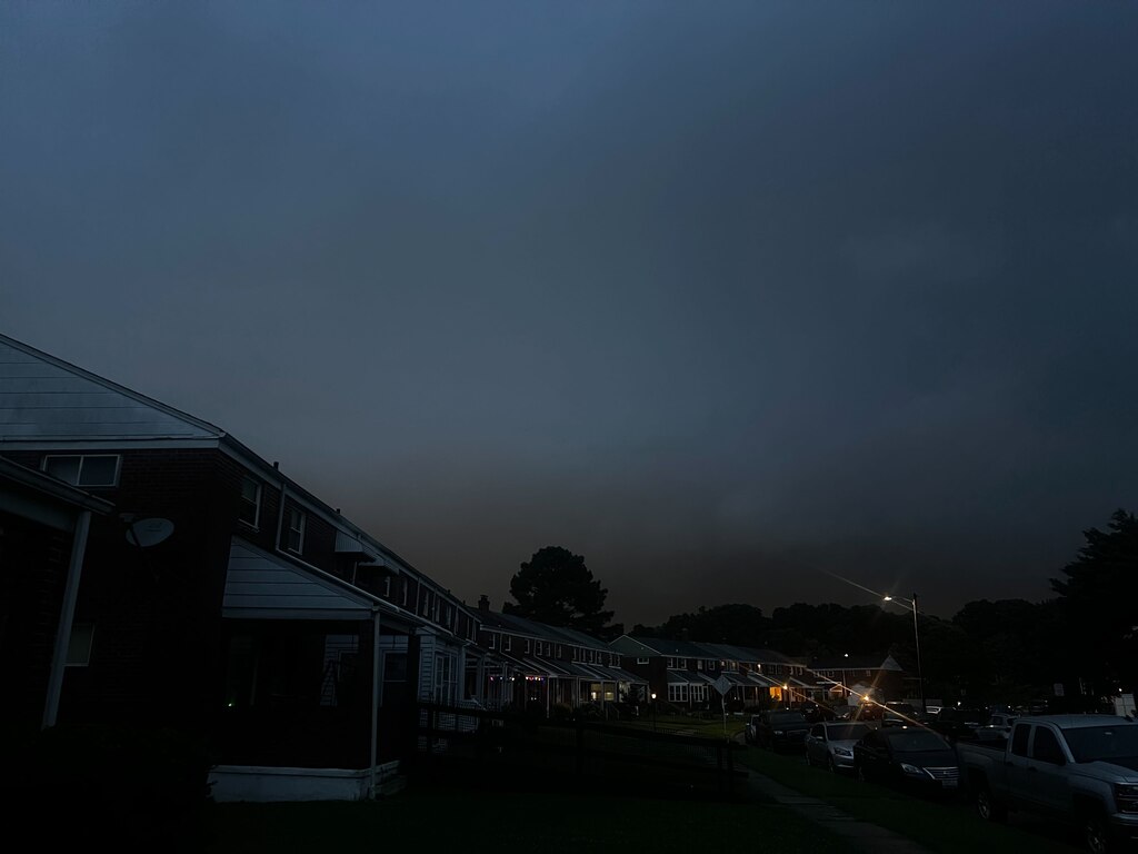
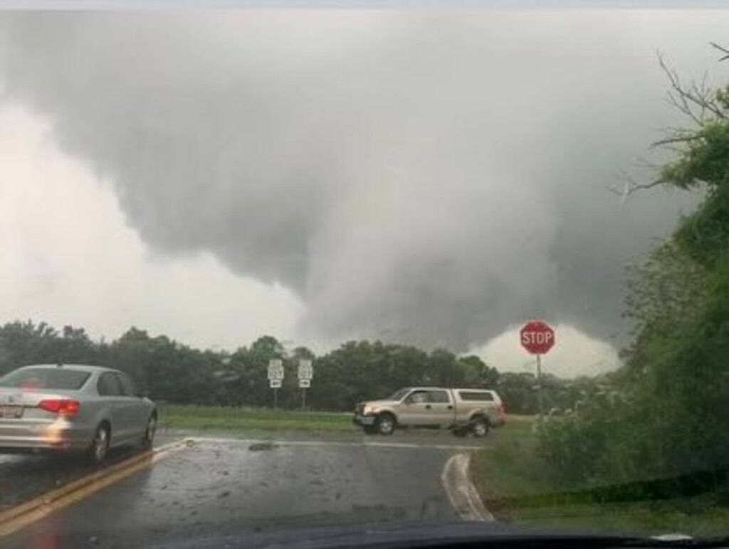
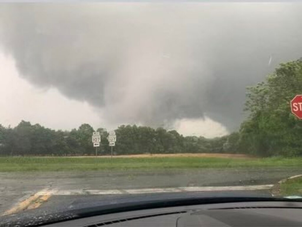
A tornado was confirmed in Montgomery County and multiple tornado warnings dotted Maryland and Baltimore as storms rolled through the state Wednesday night.
Officials said five people were rescued from a home in Gaithersburg after a large tree fell on the structure and more damage was likely to be reported Thursday morning.
Earl Stoddard, the assistant chief administrative officer for the Montgomery County executive, said it appears two tornadoes touched down, producing a large debris field spanning many miles.
At least one tornado touched down in an area called Olde Towne Gaithersburg. Stoddard said it’s one of the oldest neighborhoods in the area with older smaller homes and large mature trees.
The Baltimore Banner thanks its sponsors. Become one.
Montgomery County Fire and Rescue spokesman David Pazos said four people were removed from the home where the tree fell, and one was pinned and rescued by the Technical Rescue Team.
One person has a “traumatic” injury, but it is not life-threatening, officials said.
The ages and identities of the five people were not immediately released Wednesday night.
Some of the taller trees in the region were stripped clean Wednesday night, with at least one bent halfway up. The storm left roughly 670 residents were without power around 9 p.m., Pazos said.

One of the tornadoes appears to have touched down east of Gaithersburg, while the other was west of the area, Stoddard said. The National Weather Service will ultimately make the determination of how many tornadoes touched down and how strong those were, Stoddard said.
The Baltimore Banner thanks its sponsors. Become one.
The storm left debris down in yards in Gaithersburg. As of 9:20 p.m., utility trucks had started to move into the area.
Nakia Smith, 49, of Gaithersburg, took shelter in the basement of her home with her husband and children.
For 25 minutes, she could hear what sounded like a mix of a train and thunder, all the while tracking tornado locations on the internet. A D.C.-area native, she has lived through tornadoes in the area before, but this was the worst, she said.
”This felt like we were in California, in a movie, like ‘The Day After Tomorrow,’” said Smith, whose home was unscathed.
The National Weather Service for the Baltimore-Washington area posted online that the tornado was confirmed in Poolesville at around 7:40 p.m. The twister was the only confirmed sighting as the service issued watches and warnings for parts of Baltimore County, including Towson, and Carroll County, lasting until 8:15 p.m.
The Baltimore Banner thanks its sponsors. Become one.
The warnings shifted east to Cecil County and along the Eastern Shore and were in effect until 11 p.m.

Pazos said the possible tornado followed a path through the Poolesville, Germantown and Gaithersburg areas, leaving debris and trees in roadways. Pazos said the fire department received four dispatches for trees on homes with people trapped inside, all within the Gaithersburg area.
“Stay off the roads if all possible,” Pazos said.
Because of a long-scheduled community meeting, the mayor of Gaithersburg and many other city officials, including the City Council and city manager, were all in another part of town when the tornado warning was issued.
There was a “surreal” moment in the room when hundreds of phones started going off with the tornado warning, said Mayor Jud Ashman.
The Baltimore Banner thanks its sponsors. Become one.
As soon as there were reports that a tornado had actually touched down in the region, some police officers and other city employees left the meeting to respond, Ashman said. He said he was getting texts from people in the governor’s office, Congress, and from mayors all over the state offering support, too.
”It was quite remarkable how quickly everybody got into gear to help,” Ashman said.
There was no apparent damage to Gaithersburg City Hall, which is essentially next door to where the storm damage was. Ashman said he has not yet been able to speak with the five residents whose house was destroyed or the person who was hospitalized, but that the city’s Community Services office would be glad to help out if possible or needed.
”There’s a lot of cleanup left to do. But the thing is, I feel like we dodged a major bullet. There are a few injuries, but they’re minor,” Ashman said. “There’s one house that’s unfortunately totaled, but it could have been so much worse.”
While the tornado threat subsided as the night wore on, another round of heavy rain and isolated thunderstorms were forecast between 12 a.m. and 2 a.m. Pazos said those storms could produce more damage reports by morning.
The Baltimore Banner thanks its sponsors. Become one.
Flash flood warnings remained in effect through the night, with fog possible headed into the morning.
Several videos posted to X, formerly Twitter, showed funnel clouds in Poolesville as well as trees bending and trash flying through the air in Gaithersburg as the storms moved through those areas Wednesday night.
Victor Thaxton, a meteorology student from Germantown, said he pulled off the road onto someone’s driveway to capture images of a tornado. Between 7 p.m. and 7:30 p.m., he was able to take a video and capture photos of the storm as it traveled southwest of Poolesville.
Thaxton said his spotter report of the tornado is what caused the National Weather Service to issue its “particularly dangerous situation” warning.
Jim Brown, president of the Poolesville town commissioners in Montgomery County, said he and his family saw the tornado outside his front door.
The Baltimore Banner thanks its sponsors. Become one.
“We saw the clouds, we saw the tornado, we saw the tornado touching ground,” Brown said. “It was enough to scare the crap out of all of us.”
Then, he said, the tornado veered away — probably toward Gaithersburg, he said.
“This was not some little windstorm,” Brown said. “This was, the whole sky is moving.”

The storm took down power in the area. As of 11:45 p.m., BGE reported 2,700 customers without power in the Baltimore region on its power outage map.
The National Weather Service issued a flood watch beginning at noon when widespread rain and thunderstorms started moving across the area.
Poolesville, Maryland, tornado @MontgomeryCoMD pic.twitter.com/baqGoIqLhO
— Pete Piringer (@mcfrsPIO) June 5, 2024
Precipitation picked up as the day went on, dumping possibly three to four rounds of showers and thunderstorms over the area. The most severe storms were expected east of and along I-81 and north of I-64.
Officials throughout the region reported flooded streets and blocked roads. They encouraged people to stay home and not attempt to drive or walk through standing water.


Comments
Welcome to The Banner's subscriber-only commenting community. Please review our community guidelines.