More than 100 years ago, a pair of prominent landscape architects proposed building a tree-covered promenade in West Baltimore as part of a growing system of urban parks. After catching heat for planning to move that vision forward a couple years ago, Baltimore’s transportation department is now proposing something a bit different.
Plans for a walking, biking and rolling trail down a grassy median along Gwynns Falls Parkway in West Baltimore faced strong pushback from some community members. Officials went back to the drawing board and unveiled a new proposal last week, but the new design isn’t winning anyone over, either.
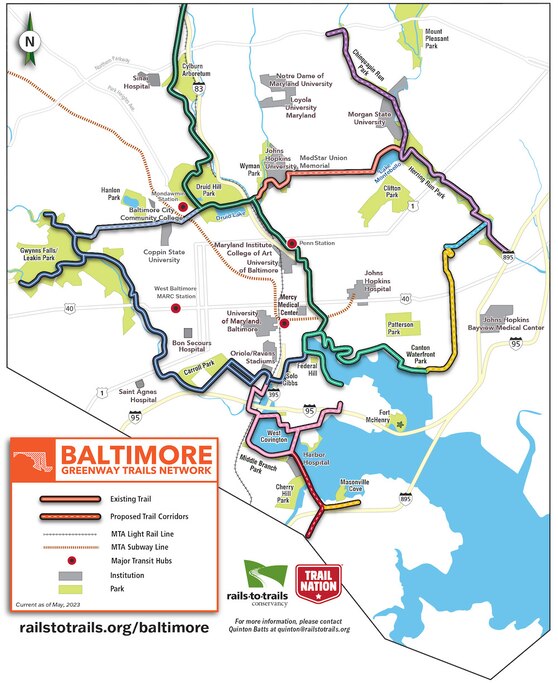
On Thursday, city transportation officials and consultants from the design firm WSP stood alongside poster boards displaying different sections of the 2½-mile proposal that would close a gap in the 35-mile Greenway Trails Network. The trail network links Baltimore neighborhoods and parks and includes areas such as the downtown promenade along the Inner Harbor, the Jones Falls Trail in Druid Hill Park and East Baltimore’s Herring Run Trail. Transportation officials say it’s part of a better-connected future Baltimore.

It has gaps. One of them is in West Baltimore where there’s no trail to connect Leakin and Druid Hill parks — and plans for filling that gap have fanned a heated debate over who gets to decide how space on Baltimore’s roadways is allocated. The city transportation department has been caught in the middle, resulting in years of unrealized plans and expensive bills to consultants.
Under the new proposal, the trail would exit Leakin Park near Hilton Avenue and head east along North Avenue, utilizing bus/bike lanes that the transportation department have installed. It would turn north onto North Dukeland Street alongside Hanlon Park, using separated bike lanes. Trail users would then turn onto Liberty Heights Avenue to head southeast toward Druid Hill Park.
The changes largely reflect what neighbors had suggested as an alternate route, said Linda Batts, president of the Hanlon Improvement Association.
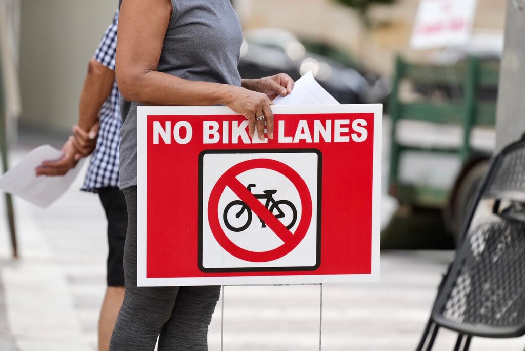
Mary Hughes, vice president of the Friends of Gwynns Falls Parkway, agreed that it reflected neighbors’ feedback but pushed back at the inclusion of a bike lane at the intersection of North Dukeland Street and Gwynns Falls Parkway. She argued that bike lanes encourage riders to disobey traffic laws and said that a recent lane reduction along Gwynns Falls Parkway has led to more congestion and cars running red lights.
Batts and Hughes did not attend the meeting because they didn’t know about it. They expressed dissatisfaction with not being invited — Batts called it a reflection of racist community engagement practices of the transportation department and “continued longstanding exclusion [of] residents along Gwynn’s Falls Parkway.”

There was plenty of pushback to go around Thursday night.
“None of this is efficient, none of it is stuff that someone cycling is actually going to do,” said Loren Simpson, who frequently bikes the area with his cycling group. He doubts the proposal would attract many users if built, in part because North and Liberty Heights Avenues aren’t friendly to nonmotorists like cyclists or pedestrians, he said.
“I would like it to be a little easier for all of us, no matter age and ability, or even If you’re not even on a bike, you could be in your wheelchair,” said Simpson.
Graham Coreil-Allen, president of the New Auchentoroly Terrace Association, said the proposal includes some positive elements, such as new traffic calming on Liberty Heights Avenue and new bike infrastructure on North Dukeland Street, to connect the trail to Hanlon Park and multiple schools. But the plan on North Avenue is a sticking point and a tough sell, he said.
“To encourage small kids riding their bikes in a bus lane on North Avenue is inviting a very dangerous situation where people will be injured and likely killed,” said Coreil-Allen. “I was hoping that they might have some type of design solution for North Avenue that maybe we hadn’t thought about. But nothing is being depicted here or shown for that segment.”
The lack of planning for pedestrians or people using mobility devices like wheelchairs doesn’t reflect “the spirit of the trail,” said Kate Foster, mid-Atlantic director of trail development for the Rails to Trails Conservancy, which spearheaded initial trail development before handing the project over to Baltimore’s DOT years ago. Foster echoed a sentiment that many at the meeting said quite plainly: The proposed plan isn’t a trail.
The opening of the meeting, which was also available to online attendees, included a brief presentation by Stuart Sirota, deputy planning director for the city Department of Transportation. Many of the roughly 30 online participants strongly criticized the plan.
Sirota mingled with attendees during an open house portion after his presentation, but declined to answer questions from The Baltimore Banner, referring inquiries to the agency’s spokespersons.
“The proposed alignment will, very literally, kill people,” wrote Liz Thornberry, one attendee.
“Bus lanes and paint aren’t a trail,” wrote Liz Johnson.
A city DOT spokesperson did not respond to a request for comment.
In June, Rails to Trails and the Central Maryland Transportation Alliance released the results of polling conducted by research company Stratalys across Baltimore and Baltimore County regarding several transportation-related questions. The results suggest only 4% of residents citywide, including respondents in the 21216 and 21217 ZIP codes that contain neighborhoods between Druid Hill and Leakin parks, opposed the creation of the trail. Seventy-one percent of respondents supported it and 25% neither supported nor opposed, the results show. Polling did not include information about specific alignments of the trail, however.
“It’s really clear that people want this [trail] and they want more options for how to move around the city. And they want to be able to do it safely,” Foster said.
Hughes and Batts don’t believe the poll results, though, arguing that they represent “selective endorsement and engagement” in order to further the organizations’ policy goals.
The Baltimore Regional Transportation Board is in the midst of its own planning for bike infrastructure across the region. Ninety-three percent of those asked through public outreach support the construction of a regional bike network, the board reported at a meeting Tuesday morning.
Mark Parker, who is running unopposed in November to replace Zeke Cohen on the City Council representing the 1st District, recognizes he’s not in a position to evaluate where West Baltimore stands in regards to the project. But as a supporter of the trail network, he went to Thursday’s meeting to better understand those voices.
Being a couple of months removed from May’s Democratic primary “allows us to get back to real conversations with our neighbors around what a safer and better connected and more active city looks like,” he said.
Parker is excited about what the Greenway Trails Network can do for Baltimore once finished. He spent time this summer on the Great Allegheny Passage trail and was struck by the “historically rich revival” around the Rust Belt towns the trail connects.
“Here in the city, we have great neighborhoods, like awesome neighborhoods, each with their own character, but they’re hidden away from each other,” said Parker. “And so to connect them to each other, and to give people a chance to bike from one to the other — kids and people all ages and all abilities — to explore and see the city in new ways … I’m incredibly excited and supportive of this project.”


Comments
Welcome to The Banner's subscriber-only commenting community. Please review our community guidelines.