Winter officially began today, though it’s been feeling like it for a while.
Temperatures peaked in the mid- to upper 40s across much of Maryland ahead of a cold front. Gusty winds returned as the front blew through. Winds occasionally gusted over 30 mph, blowing in colder weather.
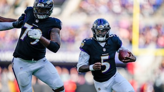
Plan on a cold Ravens game Sunday night.
Kickoff is 8:20 p.m. Temperatures are forecast to drop through the 30s and into the 20s.
It’ll be around the freezing mark at M&T Bank Stadium at kickoff. Although winds will be lighter than earlier in the day, there will be enough of a breeze to make it feel like it’s in the upper teens and 20s at times. The forecast remains dry and mostly clear through the course of the game. It’ll be around 30 degrees as the game wraps up.
Temperatures will be in the upper teens and 20s across our area early Monday. Plan on a calm and cold start to the day, under high clouds. Temperatures will remain lower than average on Monday. It’ll peak in the low to mid-40s in most communities by 3 p.m.
There will be quite a bit of sunshine through midday.
Monday night, a fast-moving storm system approaches Maryland. Scattered light showers are possible Monday evening through sunrise on Tuesday. Showers may begin as snow and sleet before transitioning to a cold rain.
The temperature will be above freezing in most areas. Cloud coverage remains hit or miss, and whatever falls from the clouds will be relatively light. This system appears as though it will have a low impact on our area early Tuesday. No significant wintry accumulation is expected.
There is a greater chance of accumulating snow across Pennsylvania.
A few light rain showers could linger into Tuesday afternoon, as temperatures reach the 40s. A gradual warming trend continues through Christmas and into the first day of Kwanzaa. Temperatures could approach 60 degrees on Friday.
Scattered rain showers will accompany the warming trend. Plan on more clouds than sun and occasional rounds of scattered wet weather through the week. Some chillier weather is expected next weekend, followed by a more noticeable change in temperature heading into the days leading up to the new year.


Comments
Welcome to The Banner's subscriber-only commenting community. Please review our community guidelines.